


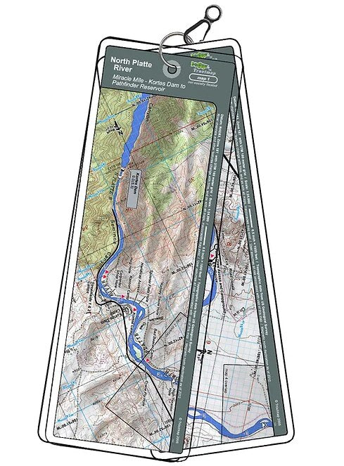
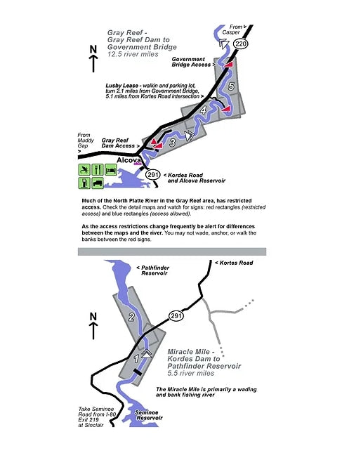
This map collection includes the 5.5 river miles of the Miracle Mile between Kordes Dam and Pathfinder Reservoir, and the 12.5 river miles of Gray Reef to Government Bridge.
The Gray Reef section partially flows through private property, which is clearly marked on the river maps.
5 river maps plus an area map
Product Info:
- Laminated and waterproof maps that follow the river channel.
- Individual maps are secured with a stainless steel split ring, and includes a snap hook that allows clipping to a cable retractor on waders or boat.
- Cable retractor is not included
- River features such as rapids, boat ramps, access points, and campgrounds are clearly shown.
- Each map set contains an area map showing the general location of fly shops, shuttles, lodging, fuel and places to eat.
- Approximate size: printed map: 3-3/8 inches by 10-1/4 inches; laminated page: 3-3/4 inches by 10-1/2 inches.