


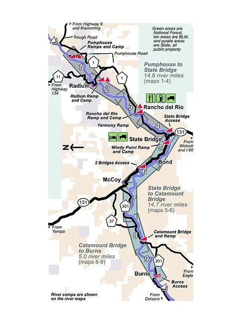
Pumphouse to Burns
This map set follows the Colorado River for 34.3 miles from Pumphouse to Burns.
9 river maps and an area maps
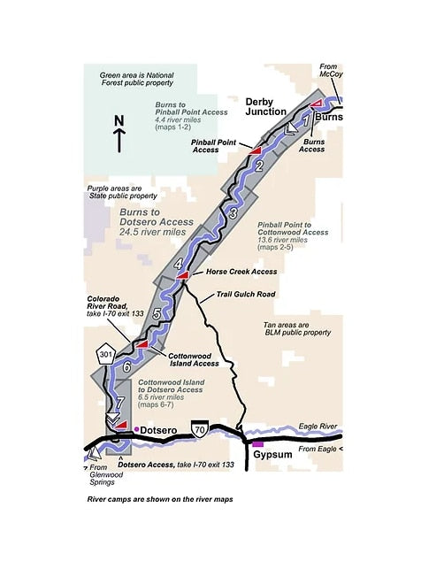
Burns to Dotsero
This map set follows the Colorado River for 24.5 miles from Burns to Dotsero.
7 river maps and an area map
Combo
This two map set combo follows the Colorado River for 58.8 miles from Pumphouse to Dotsero.
16 river maps and 2 area maps
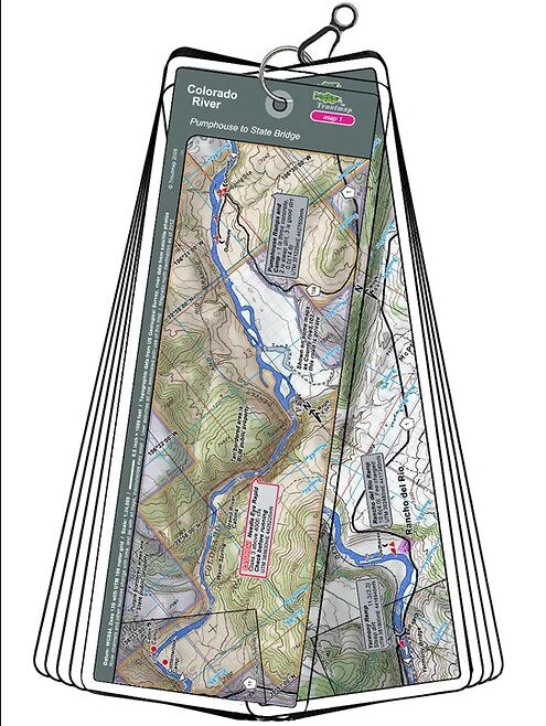
Product Info:
- Laminated and waterproof maps that follow the river channel.
- Individual maps are secured with a stainless steel split ring, and includes a snap hook that allows clipping to a cable retractor on waders or boat.
- Cable retractor is not included
- River features such as rapids, boat ramps, access points, and campgrounds are clearly shown.
- Each map set contains an area map showing the general location of fly shops, shuttles, lodging, fuel and places to eat.
- Approximate size: printed map: 3-3/8 inches by 10-1/4 inches; laminated page: 3-3/4 inches by 10-1/2 inches.